This Java 26.2 seed starts on a compact high island with steep stone faces, a snowy summit and exposed water on its slopes. Spawn is (-48, 152, -16), already on the island, with a locally checked summit about 48 blocks away horizontally.
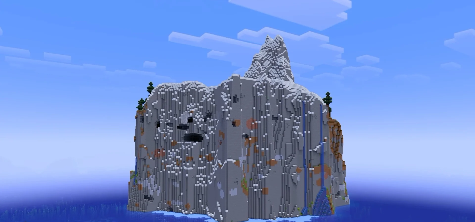
Use seed 7887773272363066711 in Java 26.2 with normal world generation and structures enabled. Distances are measured in a straight line from spawn, and structure coordinates point to the structure, so look around for the entrance when you arrive.
The high island start
Steep island terrain surrounds your high starting position. The local terrain map shows ocean around this compact landmass. Get your bearings at Y=152 before descending toward the lower openings. Coordinates: (-48, 152, -16). At spawn.
The snowy peak
A snowy summit gives you a short but steep climb above spawn. The snow block at Y=201 is the highest surface found within the local survey rectangle, in Jagged Peaks. Coordinates: (-44, 201, 32). 48 blocks from spawn.
The eastern stone cliff
Exposed stone forms the island's lower eastern face at Y=100, about 52 blocks below spawn. Plan a careful descent to inspect the wall. Coordinates: (18, 100, 0). 68 blocks from spawn.
The cliff waterfall
An exposed waterfall gives you a slope feature south of spawn. The water column falls 42 blocks, from Y=136 to Y=94. A continuous waterfall route between sea level and the summit has not been confirmed. Coordinates: (-56, 136, 85). 101 blocks from spawn.
The sea-facing recess
A lower hollow gives you a sea-facing view beneath the island rock. The marker is in air at Y=90, below solid stone at Y=110 and a surface at Y=122. Scout it as a recess rather than a sea-level dock. Coordinates: (0, 90, 60). 90 blocks from spawn.
Taiga farther west
A taiga biome lies west and slightly north of the island start. The exact waypoint is at water level, Y=62, so approach it as an exploration target; a mainland landing and supply route have not been located. Coordinates: (-336, 62, -112). 304 blocks from spawn.
Plan your route
Begin on the high island and scout the nearby summit before planning a descent. The east-face stone block and southern hollow are lower destinations; the waterfall lies southwest of the hollow and south of spawn. Explore those slopes in stages rather than assuming the water column connects every level. A specific mainland shore and supply route were not located.
For an aerial visit, switch to Creative and enable flight first. Use a command below, then descend slowly. For underground places, these commands arrive above the surface so you can plan a controlled descent.
- The snowy peak:
/tp @s -44 217 32 - The cliff waterfall:
/tp @s -56 152 85 - The sea-facing recess:
/tp @s 0 138 60
Landmark coordinates
| Place | X Y Z | Distance |
|---|---|---|
| The high island start | -48 152 -16 | at spawn |
| The snowy peak | -44 201 32 | 48 blocks |
| The eastern stone cliff | 18 100 0 | 68 blocks |
| The cliff waterfall | -56 136 85 | 101 blocks |
| The sea-facing recess | 0 90 60 | 90 blocks |
| Taiga farther west | -336 62 -112 | 304 blocks |